Site Overview
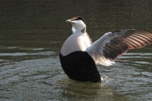
This site is a Marine Conservation Zone (MCZ) designated under the Marine and Coastal Access Act (2010) on the 31st May 2019. The designation is intended to protect populations of common eider (Somateria mollissima)
A PDF boundary map of the site can be downloaded HERE
Boundary Map and available GIS data
Conservation Objectives
The site was designated on the 31st May 2019. Conservation Objectives are not yet available. A link will be provided once they are published.
Defra has published a factsheet about the MCZ which can be viewed HERE
A short infographic summary for the site can be downloaded HERE
Organisations with responsibility for MPA
- Berwick Harbour Commission
- Environment Agency
- Natural England
- Marine Management Organisation
- North Sunderland Harbour Commission
- North Tyneside Council
- Northumberland Inshore Fisheries and Conservation Authority
- Northumberland County Council
- Northumbrian Water
- National Trust
- Warkworth Harbour Commission

