Site Overview
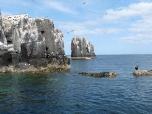
The site is a Special Protection Area (SPA) first classified in July 1985 in recognition of its internationally significant populations of breeding seabirds.
An infographic for the site can be downloaded HERE
Boundary Map and available GIS data
The boundary map for this site can be downloaded from HERE
Boundary maps of all English marine protected areas can be downloaded from Natural England at this link
Additional spatial data
The following spatial datasets may also be relevant to this site:
Additional spatial information, including the location of marine priority habitats, can be viewed and downloaded at the MAGIC website
Download an infographic about this MPA HERE
Conservation Objectives
The conservation objectives for the sites are:
Ensure that the integrity of the site is maintained or restored as appropriate, and ensure that the site contributes to achieving the aims of the Wild Birds Directive, by maintaining or restoring;
- The extent and distribution of the habitats of the qualifying features
- The structure and function of the habitats of the qualifying features
- The supporting processes on which the habitats of the qualifying features rely The population of each of the qualifying features, and,
- The distribution of the qualifying features within the site.
The site’s conservation objectives apply to the site and the individual species for which the site has been classified
Formal conservation advice has been published by Natural England and should be referred to. This gives guidance on how to further the conservation objectives for the site, identifies the activities that are capable of affecting the qualifying features and the processes which the qualifying features are dependent upon.
The conservation advice can be viewed HERE
Natural England have also produced Supplementary Guidance on the Conservation Objectives for site which aim to describe the range of ecological attributes that are most likely to contribute to a site’s overall integrity.

