Published: 26th June 2026
CoastSnap Summer News
The sunshine has been bringing more of us to the coast, and we’ve been receiving lots of photos from residents and visitors alike. So we wanted to say a big THANK YOU for all your photos! Every submission helps to build a long-term dataset of changes to the coast, helping us to understand how climatic changes are affecting Berwickshire, Northumberland and North Tyneside’s coasts. Keep those photos coming in!
Analysing your Snaps
Last winter’s storms caused heavy erosion on our beaches. In many places there were reports of shipwrecks and WW2 defences ‘surfacing’ as sand was scoured away. We’ve been working with Newcastle University to use CoastSnap images to calculate how much sand is removed after events like this. The analysis below uses photos from September 2025 (blue) and February 2026 (red) to calculate change in beach width. As the sand is washed away, the sea can reach farther up the shore. This causes the beach width to decrease.
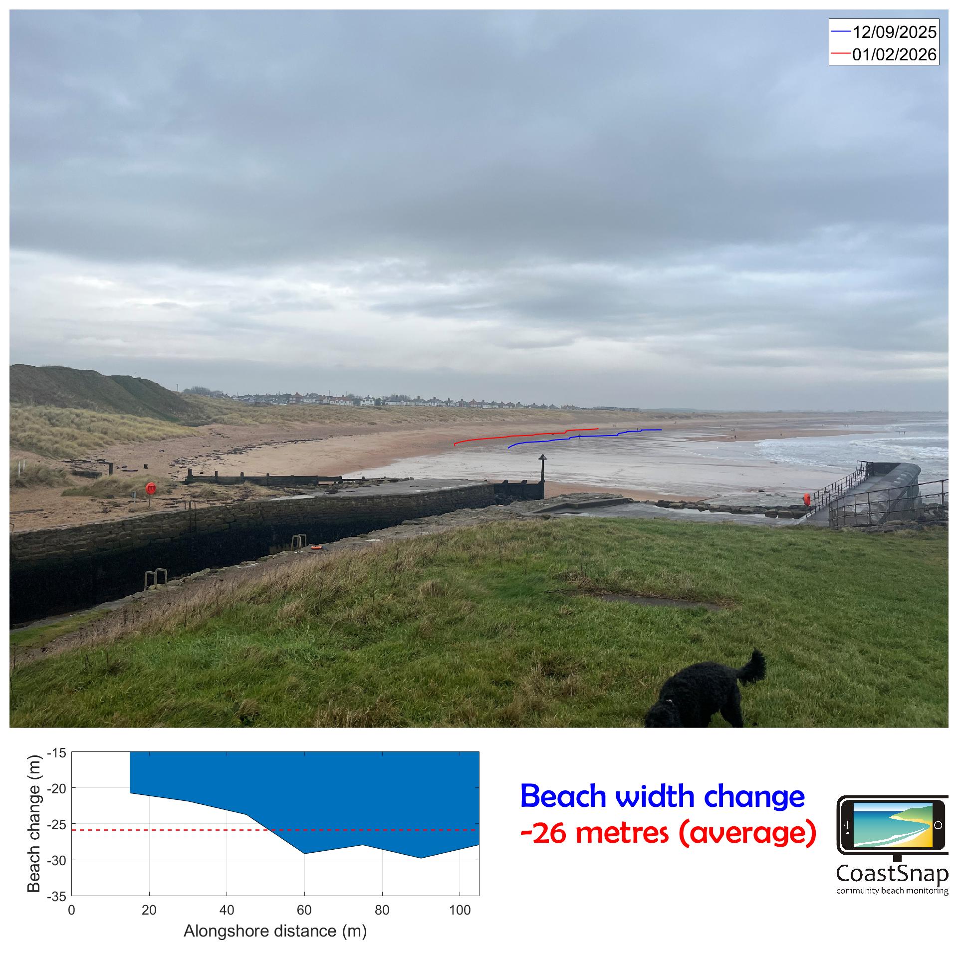
A decrease of 26 metres of beach width is huge – but don’t worry. Sandy beaches are dynamic environments, changing all the time. The sand is already building back up now the storms are (mostly!) over. Changes in coastlines happen over long time periods, and CoastSnap helps us understand long-term changes as well as short-term ones.
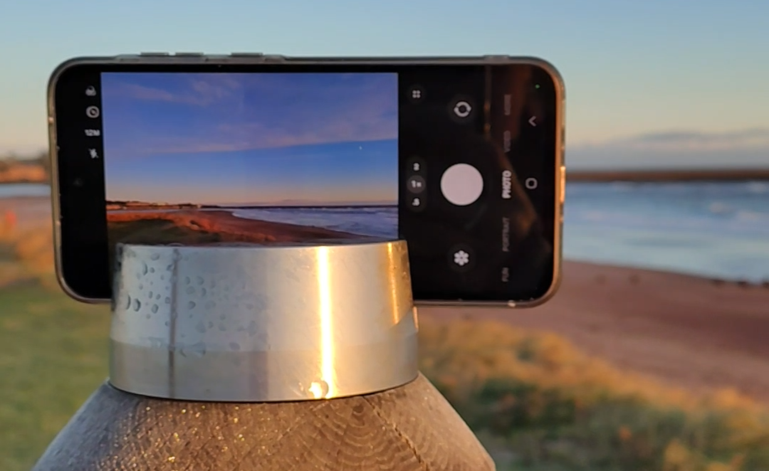
Top tips for the Perfect CoastSnap Photo
- Tell us the time ⌚ If you’re emailing or using social media to submit your photo, let us know the time and date it was taken, so we can match up the tide state correctly with your picture
- Landscape works best 🌅 This gives us a nice a wide shot of the shore and captures all the areas we’re interested in, especially our fixed location points that enable us to line up the photos for analysis.
- Don’t zoom in 📸 Again, we’re after a clear shot which takes in the whole of the view. Just take the picture on standard 1x zoom.
Most popular locations
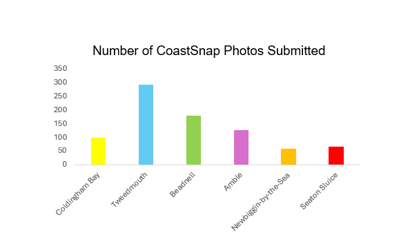
Since the first CoastSnap post went into the ground in 2023, we’ve had over 800 photos submitted across 6 locations, thanks to hundreds of you, citizen scientists. The graph below shows the number of photos at each post. Tweedmouth is leading the way, but Beadnell is not far behind. Can we reach 1000 submissions by the end of the year?
Consistency is key! If you’re regularly passing a CoastSnap post whilst out for a walk, run or cycle, take 2 minutes to snap and send a picture of the coast. For more info about the project, or to find your nearest post, visit CoastSnap | Berwickshire & Northumberland Marine Nature Partnership


